| 1979 | ||
| 19 | 80 | |
| GRASS (Geographic Resources Analysis Support System) wird beim U. S. Army Corps of Engineers‘ Construction Engineering Research Laboratory (CERL) entwickelt. | ||
| 19 | 81 | |
| ESRIvertreibt |
 |
|
| Der 80286-Prozessor wird verfügbar – Taktrate 6 MHz. | Landsat Thematic Mapper wird gestartet. | |
| 19 | 83 | |
| Entwicklung von EZS-Interaktiv mit Anwendungen aus dem kommunalen Bereich sowie Energieversorgungssektor – einschließlich EDBS-Schnittstelle. | ||
| ETAKgegründet. | ||
| 19 | 84 | |
| 1. International Spatial Data Handling Symposium, Zürich. | Beginn Einsatz des BGRUND-Verfahrens in Baden-Württemberg | |
| SICAD GDB verfügbar | ||
| Marble, Calkins & Peuquet „Basic Readings in Geographic Information Systems“ publiziert. |
||
| Beginn der Entwicklung des ATKIS-Konzepts | ||
| 19 | 85 | |
| GPS (Global Positioning System) steht operationell zur Verfügung. | ||
| Der 80386-Prozessor wird verfügbar. | Die Landnutzungskarte Baden-Württemberg wird am Institut für Photogrammetrie und Fernerkundung (Universität Karlsruhe) entwickelt. | |
| Die Entwicklung von GRASS-Geographic Resources Analysis Support System beginnt in den US Army Construction Engineering Research Laboratories. | ||
| 19 | 86 | |
| Start des ersten SPOT-Satelliten | Das Graphische Kernsystem (GKS) wird als DIN und ISO-Norm verabschiedet. |
|
| SQL wird als ANSI-Standard verabschiedet. | ||
| SICAD auf dem PC als Erfassungsarbeitsplatz. | ||
| MapInfo gegründet. | ||
| Peter Burrough veröffentlicht „Principles of Geographic Information Systems for Land Resources Assessment“, zu dieser Zeit das Standardwerk im GIS-Bereich. | 2. International Spatial Data Handling Symposium, Seattle | |
| Der erste SPOT Satellit wird gestartet. | 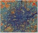 |
|
| 19 | 87 | |
| GRADIS 3000 verfügbar. | ||
| „Handling Geographic Information: the report of the Committee of Inquiry“, auch Chorley-Report gennant, erscheint. Er trägt wesentlich zur Förderungn der GI-Technologie in Großbritannien bei. | ||
| IBM und Microsoft kündigen das Betriebssystem OS/2an. | ||
| The International Journal of Geographical Information Systems wird publiziert. |  |
|
| Idrisi Project von Ron Eastman (Clark University) initiiert. | ||
| SPANS GIS von Tydac freigegeben. | ||
| 19 | 88 | |
| UK’s Regional Research Laboratory (RRL) Initiative. | ||
| National Centre for Geographic Information and Analysis NCGIA in den USA gegründet. | ||
| 1. GIS/LIS Conference in den Vereinigten Staaten. |
||
| Smallworld gegründet. | ||
| Der GIS-L Internet list-server wird von Ezra Zubrow, State University of New York at Buffalo, installiert. | ||
| Die erste Version der digitalen Geodaten TIGER (Topologically Integrated Geographic Encoding and Referencing) des US Bureau of Census publiziert. |
 |
|
| 19 | 89 | |
 |
In Großbritannien wird die Association of Geographic Information (AGI) gegründet. | |
| Der Prozessor 80486 DX ist verfügbar. | Stan Aronoff. „Geographic Information Systems: a Management Perspective“ publiziert. | |
 |
1. AGIT-Symposium in Salzburg | |
| Beginn der ATKIS-Datenerfassung | ||
| Integraph entwickelt MGE | ||
| 1990 |