Mail us : franz-josef.behr@gis-management.de

GIS-Technologie, Interoperabilität, IT, Standards

Interoperabilität, IT, Standards

Menu

Skip to content
  • Home
  • Knowhow
    • GI-Standards
    • GIS-Grundlagen
      • Vektordatenmodell
      • Attributdaten
      • Rasterorientierte geometrische Modellierung
      • Definitionen
      • Hybride Verarbeitung
      • Integration von multimedialen Daten
      • Kartographie in neuem Gewand
      • Koordinatenreferenzsysteme
    • IT-Systemeinführung
      • Systemanalyse
      • Systemauswahl
      • Inbetriebnahme
      • Literatur
    • Digitale Datenerfassung und -übernahme
    • GI-Geschichte
      • 1970 – 1980
      • 1980 – 1990
      • 1990 – 2000
      • 2000 – 2010
      • 2010 – 2020
      • Papers
      • Recht
      • Vertragsbedingungen nach EBV-IT, BVB und VOL
    • Literatur
    • Neuerscheinungen
    • Geodatenformate
      • 3D
      • XML
      • GML
      • Normbasierte Austausch Schnittstelle (NAS)
      • Flash
      • TopoJSON
      • BGRUND
      • Datenformate – länderspezifisch
      • Datenformate – nach Dateinamenserweiterungen
      • Datenformate – offizielle Normen
      • Übernahme digitaler Datenbestände
      • Nationale und internationale Normen im Bereich der Geoinformatik
      • Vertragsbedingungen nach EBV-IT, BVB und VOL
  • Links
    • Arbeitsplatzgestaltung
    • Daten
    • Jobs
    • OGC
    • Organisationen
    • Geodaten-Viewer
    • LBS
  • Produktsupport
    • Disy-Produkte
    • Autodesk®
    • ESRI®
    • GeoMedia
    • MapInfo®
    • MapInfo Tech Tips
    • MapServer
    • OpenLayers
      • Using cookies to remember the map state
    • OpenStreetMap
    • Smallworld
    • Virtuelle Globen
  • Technologie
    • SensorWeb
    • SVG
    • XML
  • Tools
    • Coordinate Transformation Service
    • GMaps2OSM
    • MapPlication
    • MapGeometry

Category Archives: Crisis Mapping

Crisis Mapping
05Feb./20

„Manual of Digital Earth“ published

05/02/2020Crisis Mapping, Literatur, Remote Sensing, Sensor WebDigital Earthfjbehr

The „Manual of Digital Earth“, the publication of the International Society for Digital Earth, has been published as open access book by Springer, edited by Huadong Guo, Michael F. Goodchild and AlessandroRead More…

Leave a comment
04Nov./19
2019 GEO Ministerial Summit & Roundtable

2019 GEO Ministerial Summit & Roundtable started

04/11/2019Crisis Mapping, Organisationen, Remote Sensing, Sustainability, VeranstaltungenEarth oberservationfjbehr

Under the theme “Earth observations: investments in the digital economy,” Ministers from GEO’s 105 Member governments will gather on 7-8 November 2019 for a roundtable discussion, dinner and Ministerial Summit to discussRead More…

Leave a comment
13Jan./18
Nepal Earthquake USGS

OGC Announces Disasters Interoperability Concept Development Study

13/01/2018Crisis Mapping, Geo-IT allgemeinCrisis Mapping, OGCfjbehr

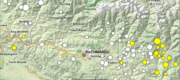
The Open Geospatial Consortium (OGC) has announced the Disasters Interoperability Concept Development Study (CDS). The CDS will assess the current state of data and product exchange technologies as used in disaster planning,Read More…

Leave a comment
09Nov./17

Modernstes Tsunami-Warnsystem der Welt entwickelt – Goldenes Lot 2017 für Dr. Jörn Lauterjung

09/11/2017Crisis Mapping, VDVGoldenes Lot, Tsunami-Frühwarnung, VDVfjbehr

Dr. Jörn Lauterjung, Direktor am Deutschen GeoForschungsZentrum GFZ wurde am 03. November in Köln für seine herausragenden Aktivitäten im Rahmen der Projektkoordination zur Entwicklung des Tsunami-Frühwarnsystems im Indischen Ozean vom Verband DeutscherRead More…

Leave a comment
24Okt./17

2017 Global platform for disaster risk reduction: Proceedings available

24/10/2017Crisis Mapping, Organisationen, VeranstaltungenDisaster, Disaster Risk Reduction, Sendai Framework, UNISDRfjbehr

This document summarises on 107 pages the proceedings of The Fifth Session of the Global Platform for Disaster Risk Reduction, which took place from 24 to 26 May 2017 in Cancún, Mexico,Read More…

Leave a comment
19Okt./17
Istanbul By Julian Nitzsche (Own work) [CC BY-SA 4.0 (https://creativecommons.org/licenses/by-sa/4.0)], via Wikimedia Commons

Geoinformation for Disaster Management Conference in Istanbul

19/10/2017Crisis Mapping, ISPRS, Kongresse, VeranstaltungenISPRSfjbehr

The world has experienced several devastating disasters in this century, first an Earthquake of a very high magnitude and then Tsunami afterwards or heavy rainfalls followed by floods and landslides, which areRead More…

Leave a comment
10Sep./17

Disaster OpenRouteService now active in the Caribbean, North America (incl. Mexico) and Bangladesh

10/09/2017Crisis MappingOpenRouteServicefjbehr

The Humanitarian OpenStreetMap Team (HOT) is currently coordinating OSM mapping activities as response to Hurricane “Irma” which is affecting the islands of the Caribbean and Florida, as well as to the severeRead More…

Leave a comment
07Jan./17

Announcement: International AGSE Winter School on Crisis and Disaster Management

07/01/2017Ausbildung, Crisis Mapping, Kongresse, VeranstaltungenAGSE, Disaster Management, HFTfjbehr

The International AGSE Winter School on Crisis and Disaster Management is organized by the Geomatics Department at the University of Applied Sciences Stuttgart and the Department of Geomatics Engineering of the UniversityRead More…

Leave a comment
07Jan./17

HOT Summit 2016 videos now available

07/01/2017Crisis Mapping, Firmennachrichten, VeranstaltungenHumanitarian OpenStreetMap Teamfjbehr

On September 22 2016, community builders, development professionals, educators, geographers, humanitarians, journalists, philanthropists, programmers, and volunteer mappers came together to learn, discuss and share ideas on how open geospatial data and theRead More…

Leave a comment
12Dez./16

Free Report: Drones in Humanitarian Action

12/12/2016Crisis Mapping, FirmennachrichtenCartONG, Disaster Management, dronesfjbehr

UAVs (Unmanned Aerial Vehicles), also known as drones and RPAS, are used more and more in various fields for imagery, transport and other purposes. Humanitarian organisations, but also actors not traditionally involvedRead More…

Leave a comment

Posts navigation

  • 1
  • 2
  • 3
  • 4
  • Next »

Buch des Monats

Geospatial Analysis: A Comprehensive Guide

Meta

  • Anmelden
  • Feed der Einträge
  • Kommentar-Feed
  • WordPress.org

Buch des Monats

Geospatial Analysis: A Comprehensive Guide

Meta

  • Anmelden
  • Feed der Einträge
  • Kommentar-Feed
  • WordPress.org

Buch des Monats

Geospatial Analysis: A Comprehensive Guide

GeoIT-Shop

Meta

  • Anmelden
  • Feed der Einträge
  • Kommentar-Feed
  • WordPress.org

Schlagwörter

3D Cadenza Cadenza Mobile Cadenza Web CartONG Crisis Mapping CrowdSourcing Datenschutz Disaster Management disy Disy Informationssysteme GmbH Esri FOSS4G FOSSGIS GDI Geodata Geodaten GIS GIS-Jobs GML Google ICA INSPIRE Intergeo ISO-Standards ISPRS Kartographie Nachhaltigkeit OGC OGC-Standards OGC-Standards, ISO-Standards Open Data OpenLayers Open Source OpenStreetMap OSGeo Photogrammetry Remote Sensing Reporting SDI SensorWeb Smart Cities Stadtplanung Webmapping Weiterbildung

Impressum

Imprint | Impressum

Buch des Monats

Geospatial Analysis: A Comprehensive Guide

GeoIT-Shop

Meta

  • Anmelden
  • Feed der Einträge
  • Kommentar-Feed
  • WordPress.org

Schlagwörter

3D Cadenza Cadenza Mobile Cadenza Web CartONG Crisis Mapping CrowdSourcing Datenschutz Disaster Management disy Disy Informationssysteme GmbH Esri FOSS4G FOSSGIS GDI Geodata Geodaten GIS GIS-Jobs GML Google ICA INSPIRE Intergeo ISO-Standards ISPRS Kartographie Nachhaltigkeit OGC OGC-Standards OGC-Standards, ISO-Standards Open Data OpenLayers Open Source OpenStreetMap OSGeo Photogrammetry Remote Sensing Reporting SDI SensorWeb Smart Cities Stadtplanung Webmapping Weiterbildung
Copyright © GIS-Technologie, Interoperabilität, IT, Standards
Powered by WordPress , Designed and Developed by templatesnext