Mail us : franz-josef.behr@gis-management.de

GIS-Technologie, Interoperabilität, IT, Standards

Interoperabilität, IT, Standards

Menu

Skip to content
  • Home
  • Knowhow
    • GI-Standards
    • GIS-Grundlagen
      • Vektordatenmodell
      • Attributdaten
      • Rasterorientierte geometrische Modellierung
      • Definitionen
      • Hybride Verarbeitung
      • Integration von multimedialen Daten
      • Kartographie in neuem Gewand
      • Koordinatenreferenzsysteme
    • IT-Systemeinführung
      • Systemanalyse
      • Systemauswahl
      • Inbetriebnahme
      • Literatur
    • Digitale Datenerfassung und -übernahme
    • GI-Geschichte
      • 1970 – 1980
      • 1980 – 1990
      • 1990 – 2000
      • 2000 – 2010
      • 2010 – 2020
      • Papers
      • Recht
      • Vertragsbedingungen nach EBV-IT, BVB und VOL
    • Literatur
    • Neuerscheinungen
    • Geodatenformate
      • 3D
      • XML
      • GML
      • Normbasierte Austausch Schnittstelle (NAS)
      • Flash
      • TopoJSON
      • BGRUND
      • Datenformate – länderspezifisch
      • Datenformate – nach Dateinamenserweiterungen
      • Datenformate – offizielle Normen
      • Übernahme digitaler Datenbestände
      • Nationale und internationale Normen im Bereich der Geoinformatik
      • Vertragsbedingungen nach EBV-IT, BVB und VOL
  • Links
    • Arbeitsplatzgestaltung
    • Daten
    • Jobs
    • OGC
    • Organisationen
    • Geodaten-Viewer
    • LBS
  • Produktsupport
    • Disy-Produkte
    • Autodesk®
    • ESRI®
    • GeoMedia
    • MapInfo®
    • MapInfo Tech Tips
    • MapServer
    • OpenLayers
      • Using cookies to remember the map state
    • OpenStreetMap
    • Smallworld
    • Virtuelle Globen
  • Technologie
    • SensorWeb
    • SVG
    • XML
  • Tools
    • Coordinate Transformation Service
    • GMaps2OSM
    • MapPlication
    • MapGeometry

Category Archives: Organisationen

Organisationen
14Dez./21

HOT seeks expertise in designing web applications for publishing satellite and aerial imagery in the cloud

14/12/2021HOTfjbehr

Humanitarian OpenStreetMap Team (HOT)is looking to engage the services of an individual or a firm with expertise in designing web applications for publishing satellite and aerial imagery in the cloud. HOT isRead More…
Leave a comment
09März/21

OGC Introduces Visiting Fellow Program

09/03/2021GIS-Jobs, OGCOGCfjbehr

The Open Geospatial Consortium (OGC) announces its new Visiting Fellow program, launching in 2021. The program has been established to support OGC’s integrated standards and innovation strategy, which falls under the leadershipRead More…

Leave a comment
24Feb./21

Revised Dates for Papers and Abstracts for ICC2021

24/02/2021ICA, KongresseKartographiefjbehr

The dates for the ICC2021 in Florence Italy have been moved from July to December 14-18, 2021 in response to the current effects of the pandemic. With this extended period, the ICC2021Read More…

Leave a comment
18Feb./21

FOSSGIS-Konferenz 2021 findet online statt

18/02/2021Open Source, OpenStreetMap, OSGeo, VeranstaltungenFOSSGISfjbehr

Am 16.02.2021 wurde in der FOSSGIS-Vereins-Vorstandssitzung beschlossen, dass die FOSSGIS-Konferenz 2021 ausschließlich Online stattfinden wird. Der Call for Participation ist gelaufen, dass Programmkomitee ist derzeit im Review und wird sich Anfang MärzRead More…

Leave a comment
10Feb./21

ICA joins the OGC as Associate Member

10/02/2021Firmennachrichten, ICA, OGCICA, OGCfjbehr

The ICA recently joined the Open Geospatial Consortium (OGC) as an associate member. As an international consortium of more than 500 businesses, government agencies, research organizations, and universities, the OGC focuses onRead More…

Leave a comment
30Nov./20

ICA joins the OGC as Associate Member

30/11/2020ICA, OGCICA, OGCfjbehr

The ICA recently joined the Open Geospatial Consortium (OGC) as an associate member. As an international consortium of more than 500 businesses, government agencies, research organizations, and universities, the OGC focuses onRead More…

Leave a comment
25Nov./20

Frischer Wind in Richtung OpenStreetMap Community – BKG tritt FOSSGIS e. V. bei

25/11/2020BKG, OpenStreetMap, OrganisationenBKG, FOSSGIS, OpenStreetMapfjbehr

Das Bundesamt für Kartographie und Geodäsie (BKG) baut die Kooperation mit der der OpenStreetMap (OSM) Community aus.

Leave a comment
26Juni/20

W3C/OGC Joint Workshop Series on Maps for the Web

26/06/2020OGC, VeranstaltungenOGC, W3C, Web Mappingfjbehr

THe workshop series „Maps for the Web“ brings together experts in geographic standards and Web map data services, Web mapping client tools and applications, and Web platform standards and browser development, toRead More…

Leave a comment
18Feb./20

Erinnerung: Münchner GI-Runde 2019 am 14. und 15. März

18/02/2020Firmennachrichten, Organisationen, VeranstaltungenKI, Münchner GI-Rundefjbehr

Die sechste Münchner GI-Runde am 14. und 15. März 2019 an der TU München nicht widmet sich den aktuellen Entwicklungen in der Welt der Geoinformation widmen. Die GI-Runde führt dabei Wissenschaftler, Praktiker,Read More…

Leave a comment
04Nov./19
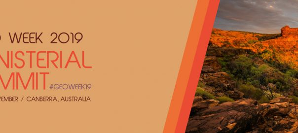
2019 GEO Ministerial Summit & Roundtable

2019 GEO Ministerial Summit & Roundtable started

04/11/2019Crisis Mapping, Organisationen, Remote Sensing, Sustainability, VeranstaltungenEarth oberservationfjbehr

Under the theme “Earth observations: investments in the digital economy,” Ministers from GEO’s 105 Member governments will gather on 7-8 November 2019 for a roundtable discussion, dinner and Ministerial Summit to discussRead More…

Leave a comment

Posts navigation

  • 1
  • 2
  • 3
  • …
  • 8
  • Next »

Buch des Monats

Geospatial Analysis: A Comprehensive Guide

Meta

  • Anmelden
  • Feed der Einträge
  • Kommentar-Feed
  • WordPress.org

Buch des Monats

Geospatial Analysis: A Comprehensive Guide

Meta

  • Anmelden
  • Feed der Einträge
  • Kommentar-Feed
  • WordPress.org

Buch des Monats

Geospatial Analysis: A Comprehensive Guide

GeoIT-Shop

Meta

  • Anmelden
  • Feed der Einträge
  • Kommentar-Feed
  • WordPress.org

Schlagwörter

3D Cadenza Cadenza Mobile Cadenza Web CartONG Crisis Mapping CrowdSourcing Datenschutz Disaster Management disy Disy Informationssysteme GmbH Esri FOSS4G FOSSGIS GDI Geodata Geodaten GIS GIS-Jobs GML Google ICA INSPIRE Intergeo ISO-Standards ISPRS Kartographie Nachhaltigkeit OGC OGC-Standards OGC-Standards, ISO-Standards Open Data OpenLayers Open Source OpenStreetMap OSGeo Photogrammetry Remote Sensing Reporting SDI SensorWeb Smart Cities Stadtplanung Webmapping Weiterbildung

Impressum

Imprint | Impressum

Buch des Monats

Geospatial Analysis: A Comprehensive Guide

GeoIT-Shop

Meta

  • Anmelden
  • Feed der Einträge
  • Kommentar-Feed
  • WordPress.org

Schlagwörter

3D Cadenza Cadenza Mobile Cadenza Web CartONG Crisis Mapping CrowdSourcing Datenschutz Disaster Management disy Disy Informationssysteme GmbH Esri FOSS4G FOSSGIS GDI Geodata Geodaten GIS GIS-Jobs GML Google ICA INSPIRE Intergeo ISO-Standards ISPRS Kartographie Nachhaltigkeit OGC OGC-Standards OGC-Standards, ISO-Standards Open Data OpenLayers Open Source OpenStreetMap OSGeo Photogrammetry Remote Sensing Reporting SDI SensorWeb Smart Cities Stadtplanung Webmapping Weiterbildung
Copyright © GIS-Technologie, Interoperabilität, IT, Standards
Powered by WordPress , Designed and Developed by templatesnext