Mail us : franz-josef.behr@gis-management.de

GIS-Technologie, Interoperabilität, IT, Standards

Interoperabilität, IT, Standards

Menu

Skip to content
  • Home
  • Knowhow
    • GI-Standards
    • GIS-Grundlagen
      • Vektordatenmodell
      • Attributdaten
      • Rasterorientierte geometrische Modellierung
      • Definitionen
      • Hybride Verarbeitung
      • Integration von multimedialen Daten
      • Kartographie in neuem Gewand
      • Koordinatenreferenzsysteme
    • IT-Systemeinführung
      • Systemanalyse
      • Systemauswahl
      • Inbetriebnahme
      • Literatur
    • Digitale Datenerfassung und -übernahme
    • GI-Geschichte
      • 1970 – 1980
      • 1980 – 1990
      • 1990 – 2000
      • 2000 – 2010
      • 2010 – 2020
      • Papers
      • Recht
      • Vertragsbedingungen nach EBV-IT, BVB und VOL
    • Literatur
    • Neuerscheinungen
    • Geodatenformate
      • 3D
      • XML
      • GML
      • Normbasierte Austausch Schnittstelle (NAS)
      • Flash
      • TopoJSON
      • BGRUND
      • Datenformate – länderspezifisch
      • Datenformate – nach Dateinamenserweiterungen
      • Datenformate – offizielle Normen
      • Übernahme digitaler Datenbestände
      • Nationale und internationale Normen im Bereich der Geoinformatik
      • Vertragsbedingungen nach EBV-IT, BVB und VOL
  • Links
    • Arbeitsplatzgestaltung
    • Daten
    • Jobs
    • OGC
    • Organisationen
    • Geodaten-Viewer
    • LBS
  • Produktsupport
    • Disy-Produkte
    • Autodesk®
    • ESRI®
    • GeoMedia
    • MapInfo®
    • MapInfo Tech Tips
    • MapServer
    • OpenLayers
      • Using cookies to remember the map state
    • OpenStreetMap
    • Smallworld
    • Virtuelle Globen
  • Technologie
    • SensorWeb
    • SVG
    • XML
  • Tools
    • Coordinate Transformation Service
    • GMaps2OSM
    • MapPlication
    • MapGeometry

Category Archives: Sustainability

Sustainability
04Nov./19
2019 GEO Ministerial Summit & Roundtable

2019 GEO Ministerial Summit & Roundtable started

04/11/2019Crisis Mapping, Organisationen, Remote Sensing, Sustainability, VeranstaltungenEarth oberservationfjbehr

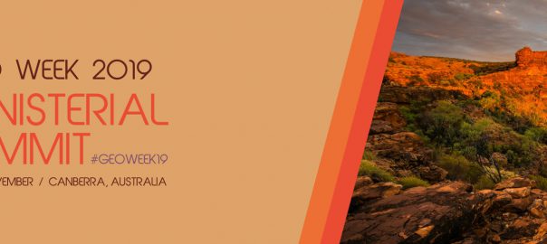
Under the theme “Earth observations: investments in the digital economy,” Ministers from GEO’s 105 Member governments will gather on 7-8 November 2019 for a roundtable discussion, dinner and Ministerial Summit to discussRead More…

Leave a comment
21Juli/19

The State of Food Security and Nutrition in the World 2019

21/07/2019SustainabilitySDGsfjbehr

As reported by Dr. Suchith Anand, Chief Scientist, Global Open Data for Agriculture and Nutrition the State of Food Security and Nutrition in the World was recently published. The report is jointlyRead More…

Leave a comment

Buch des Monats

Geospatial Analysis: A Comprehensive Guide

Meta

  • Anmelden
  • Feed der Einträge
  • Kommentar-Feed
  • WordPress.org

Buch des Monats

Geospatial Analysis: A Comprehensive Guide

Meta

  • Anmelden
  • Feed der Einträge
  • Kommentar-Feed
  • WordPress.org

Buch des Monats

Geospatial Analysis: A Comprehensive Guide

GeoIT-Shop

Meta

  • Anmelden
  • Feed der Einträge
  • Kommentar-Feed
  • WordPress.org

Schlagwörter

3D Cadenza Cadenza Mobile Cadenza Web CartONG Crisis Mapping CrowdSourcing Datenschutz Disaster Management disy Disy Informationssysteme GmbH Esri FOSS4G FOSSGIS GDI Geodata Geodaten GIS GIS-Jobs GML Google ICA INSPIRE Intergeo ISO-Standards ISPRS Kartographie Nachhaltigkeit OGC OGC-Standards OGC-Standards, ISO-Standards Open Data OpenLayers Open Source OpenStreetMap OSGeo Photogrammetry Remote Sensing Reporting SDI SensorWeb Smart Cities Stadtplanung Webmapping Weiterbildung

Impressum

Imprint | Impressum

Buch des Monats

Geospatial Analysis: A Comprehensive Guide

GeoIT-Shop

Meta

  • Anmelden
  • Feed der Einträge
  • Kommentar-Feed
  • WordPress.org

Schlagwörter

3D Cadenza Cadenza Mobile Cadenza Web CartONG Crisis Mapping CrowdSourcing Datenschutz Disaster Management disy Disy Informationssysteme GmbH Esri FOSS4G FOSSGIS GDI Geodata Geodaten GIS GIS-Jobs GML Google ICA INSPIRE Intergeo ISO-Standards ISPRS Kartographie Nachhaltigkeit OGC OGC-Standards OGC-Standards, ISO-Standards Open Data OpenLayers Open Source OpenStreetMap OSGeo Photogrammetry Remote Sensing Reporting SDI SensorWeb Smart Cities Stadtplanung Webmapping Weiterbildung
Copyright © GIS-Technologie, Interoperabilität, IT, Standards
Powered by WordPress , Designed and Developed by templatesnext