Mail us : franz-josef.behr@gis-management.de

GIS-Technologie, Interoperabilität, IT, Standards

Interoperabilität, IT, Standards

Menu

Skip to content
  • Home
  • Knowhow
    • GI-Standards
    • GIS-Grundlagen
      • Vektordatenmodell
      • Attributdaten
      • Rasterorientierte geometrische Modellierung
      • Definitionen
      • Hybride Verarbeitung
      • Integration von multimedialen Daten
      • Kartographie in neuem Gewand
      • Koordinatenreferenzsysteme
    • IT-Systemeinführung
      • Systemanalyse
      • Systemauswahl
      • Inbetriebnahme
      • Literatur
    • Digitale Datenerfassung und -übernahme
    • GI-Geschichte
      • 1970 – 1980
      • 1980 – 1990
      • 1990 – 2000
      • 2000 – 2010
      • 2010 – 2020
      • Papers
      • Recht
      • Vertragsbedingungen nach EBV-IT, BVB und VOL
    • Literatur
    • Neuerscheinungen
    • Geodatenformate
      • 3D
      • XML
      • GML
      • Normbasierte Austausch Schnittstelle (NAS)
      • Flash
      • TopoJSON
      • BGRUND
      • Datenformate – länderspezifisch
      • Datenformate – nach Dateinamenserweiterungen
      • Datenformate – offizielle Normen
      • Übernahme digitaler Datenbestände
      • Nationale und internationale Normen im Bereich der Geoinformatik
      • Vertragsbedingungen nach EBV-IT, BVB und VOL
  • Links
    • Arbeitsplatzgestaltung
    • Daten
    • Jobs
    • OGC
    • Organisationen
    • Geodaten-Viewer
    • LBS
  • Produktsupport
    • Disy-Produkte
    • Autodesk®
    • ESRI®
    • GeoMedia
    • MapInfo®
    • MapInfo Tech Tips
    • MapServer
    • OpenLayers
      • Using cookies to remember the map state
    • OpenStreetMap
    • Smallworld
    • Virtuelle Globen
  • Technologie
    • SensorWeb
    • SVG
    • XML
  • Tools
    • Coordinate Transformation Service
    • GMaps2OSM
    • MapPlication
    • MapGeometry

Willkommen!

Vision is the Art of seeing things invisible. Jonathan Swift, 1667-1745

GIS-Technologie, Interoperabilität, IT, Standards | Interoperabilität, IT, Standards

Weiterbildung

We don't know the OS that God uses, but the Vatican uses Linux, Sister Judith Zoebelein, Vatican Webmaster, http://www.linuxtoday.com/infrastructure/2007022103026INCY

Know More

Technologie, Standards

Growing old is mandatory. Growing up is optional.

Know More

Visionen

Cherish your visions. Cherish your ideals. ... for out of them will grow all delightful conditions, all heavenly environment. James Allen (1902)

Know More
10Feb./20

hale-Anwenderforum 2020

10/02/2020Ausbildung, Firmennachrichten, Veranstaltungenhale, wetransformfjbehr

Am 29. und 30. Januar trafen sich über 40 INSPIRE-Nutzende und Fachleute zum diesjährigen hale»Anwenderforum in Darmstadt. Neben der Umsetzung von INSPIRE ging es um kommunale Herausforderungen wie XPlanung und darum, wieRead More…

Leave a comment
05Feb./20

„Manual of Digital Earth“ published

05/02/2020Crisis Mapping, Literatur, Remote Sensing, Sensor WebDigital Earthfjbehr

The „Manual of Digital Earth“, the publication of the International Society for Digital Earth, has been published as open access book by Springer, edited by Huadong Guo, Michael F. Goodchild and AlessandroRead More…

Leave a comment
01Feb./20

Search Engine Optimization für Geodaten

01/02/2020GeodatenGeodaten, SEOfjbehr

Geodaten sind ein wertvoller Schatz, der leider nur allzuoft im Verborgenen schlummert. Die Geospatial Commission von Groß-Britannien hat nun ein kleinen Ratgeber herausgegeben, der Geodatenanbieter dabei unterstützen soll, dass Geodaten für SuchmaschinenRead More…

Leave a comment
27Jan./20

Norm-Entwurf E DIN EN ISO 19111 „Geoinformation – Koordinatenreferenzsysteme (ISO 19111:2019)“ erschienen

27/01/2020Geo-IT allgemeinfjbehr

Mit Ausgabedatum 2019-12 der Norm-Entwurf E DIN EN ISO 19111 „Geoinformation – Koordinatenreferenzsysteme (ISO 19111:2019); Englische Fassung prEN ISO 19111:2019“ erschienen. Diese Norm definiert das konzeptionelle Schema für die Beschreibung der ReferenzierungRead More…

Leave a comment
04Nov./19
2019 GEO Ministerial Summit & Roundtable

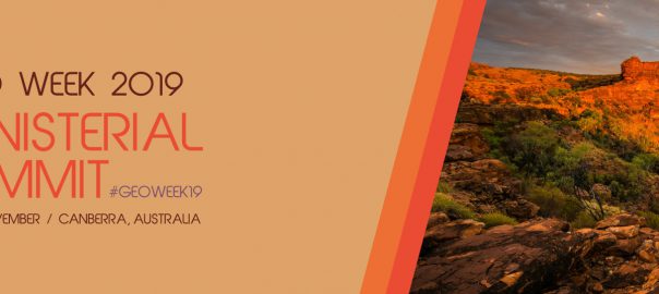
2019 GEO Ministerial Summit & Roundtable started

04/11/2019Crisis Mapping, Organisationen, Remote Sensing, Sustainability, VeranstaltungenEarth oberservationfjbehr

Under the theme “Earth observations: investments in the digital economy,” Ministers from GEO’s 105 Member governments will gather on 7-8 November 2019 for a roundtable discussion, dinner and Ministerial Summit to discussRead More…

Leave a comment
23Okt./19

OGC invites to its Augmented Reality (AR) Summit in Toulouse, France

23/10/2019OGC, VeranstaltungenAugmented Reality, OGCfjbehr

OGC’s November 2019 AR Summit will bring together experts to discuss how to standardize access to AR related data and services, and encourage AR’s proliferation

Leave a comment
09Okt./19

Freistaat Sachsen stellt Geobasisdaten als Open-Data bereit

09/10/2019ALKIS, GDI, Open DataOpen Data, Sachsenfjbehr

Der Freistaat Sachsen stellt seine digitalen Geobasisdaten als Open-Data bereit. Am 2. September 2019 schaltet der Staatsbetrieb Geobasisinformation und Vermessung Sachsen seine neue Internetseite „Offene Geodaten“ frei. Über diese stehen u. a.Read More…

Leave a comment
01Okt./19

geo.okapi – eine sehr interessante Online Karten API des Bundesamtes für Kartographie und Geodäsie!

01/10/2019Geo-IT allgemeingeo.okapi, OpenLayersfjbehr

Als Nachfolger der BKG WebMap steht seit Juli 2019 „geo.okapi„, die Online Karten API des Bundesamtes für Kartographie und Geodäsie (BKG), kostenfrei zur Verfügung.

Leave a comment
17Sep./19

4. Sitzung Workshop ArcGIS Online / Portal for ArcGIS der Städte und Landkreise BW

17/09/2019Esri, VeranstaltungenArcGIS, Esri, Karlsruhefjbehr

Die 4. Sitzung Workshop ArcGIS Online / Portal for ArcGIS der Städte und Landkreise BW findet am Dienstag, 17.03.2020, von 10:00 – 16:00 Uhr, im Landratsamt Karlsruhe, Beiertheimer Allee 2, Karlsruhe, 19.OG,Read More…

Leave a comment
14Sep./19

OGC 2019 September Technical Committee Meeting Summary available

14/09/2019OGC-Standards, ISO-Standards, VeranstaltungenOGCfjbehr

OGC held its 112th Technical Committee Meeting in Banff, Canada this week. If you are interested in what happened over the course of the week, please see the consolidated slides from ourRead More…

Leave a comment

Posts navigation

  • « Previous
  • 1
  • 2
  • 3
  • 4
  • 5
  • 6
  • …
  • 120
  • Next »

Buch des Monats

Geospatial Analysis: A Comprehensive Guide

Meta

  • Anmelden
  • Feed der Einträge
  • Kommentar-Feed
  • WordPress.org

Buch des Monats

Geospatial Analysis: A Comprehensive Guide

Meta

  • Anmelden
  • Feed der Einträge
  • Kommentar-Feed
  • WordPress.org

Buch des Monats

Geospatial Analysis: A Comprehensive Guide

GeoIT-Shop

Meta

  • Anmelden
  • Feed der Einträge
  • Kommentar-Feed
  • WordPress.org

Schlagwörter

3D Cadenza Cadenza Mobile Cadenza Web CartONG Crisis Mapping CrowdSourcing Datenschutz Disaster Management disy Disy Informationssysteme GmbH Esri FOSS4G FOSSGIS GDI Geodata Geodaten GIS GIS-Jobs GML Google ICA INSPIRE Intergeo ISO-Standards ISPRS Kartographie Nachhaltigkeit OGC OGC-Standards OGC-Standards, ISO-Standards Open Data OpenLayers Open Source OpenStreetMap OSGeo Photogrammetry Remote Sensing Reporting SDI SensorWeb Smart Cities Stadtplanung Webmapping Weiterbildung

Impressum

Imprint | Impressum

Buch des Monats

Geospatial Analysis: A Comprehensive Guide

GeoIT-Shop

Meta

  • Anmelden
  • Feed der Einträge
  • Kommentar-Feed
  • WordPress.org

Schlagwörter

3D Cadenza Cadenza Mobile Cadenza Web CartONG Crisis Mapping CrowdSourcing Datenschutz Disaster Management disy Disy Informationssysteme GmbH Esri FOSS4G FOSSGIS GDI Geodata Geodaten GIS GIS-Jobs GML Google ICA INSPIRE Intergeo ISO-Standards ISPRS Kartographie Nachhaltigkeit OGC OGC-Standards OGC-Standards, ISO-Standards Open Data OpenLayers Open Source OpenStreetMap OSGeo Photogrammetry Remote Sensing Reporting SDI SensorWeb Smart Cities Stadtplanung Webmapping Weiterbildung
Copyright © GIS-Technologie, Interoperabilität, IT, Standards
Powered by WordPress , Designed and Developed by templatesnext